Magnitude 5.4 Earthquake Strikes Occidental Mindoro, Felt Across Over a Dozen Areas
Key Takeaways
- •A magnitude 5.4 tectonic earthquake with a focal depth of 14 kilometers struck approximately 13 kilometers southwest of Mamburao, Occidental Mindoro, on Friday morning.
- •PHIVOLCS reported that no damage is expected from the tremor, but aftershocks are likely to occur in the affected region.
- •Shaking from the earthquake was felt at varying intensities across multiple provinces, with Intensity V recorded in several Mindoro localities and Intensity II to III observed in parts of Metro Manila and nearby areas.
- •The earthquake was possibly generated by movement along a local fault, according to PHIVOLCS.
- •The Philippines' location within the seismically active Pacific Ring of Fire makes it prone to frequent earthquakes, with Mindoro having experienced major seismic events in the past.
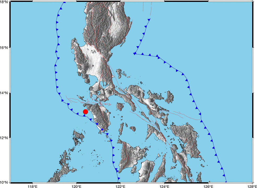
A magnitude 5.4 earthquake struck near Mamburao, Occidental Mindoro, on Friday morning, with shaking reported in more than a dozen areas across the Philippines, including parts of Metro Manila, according to the Philippine Institute of Volcanology and Seismology (PHIVOLCS).
The tremor occurred at 10:38 a.m., with its epicenter located approximately 13 kilometers southwest of Mamburao, Occidental Mindoro, as detailed in PHIVOLCS Earthquake Information No. 2. The agency classified the earthquake as tectonic in origin, with a focal depth of 14 kilometers.
PHIVOLCS stated that no damage is expected from the earthquake, though aftershocks are anticipated. In a Viber message, the agency noted that the quake was possibly generated by movement along a local fault.
The Philippines sits within the Pacific Ring of Fire, a seismically active region where tectonic plate interactions frequently produce earthquakes. Mindoro itself has a notable seismic history, including the November 1994 magnitude 7.1 earthquake that struck off the coast of Oriental Mindoro, which generated a localized tsunami and caused significant casualties and infrastructure damage. PHIVOLCS, the government agency responsible for monitoring volcanic and seismic activity, regularly issues earthquake bulletins to provide the public with timely information on seismic events.
Felt Intensities
PHIVOLCS reported the following intensity levels across affected areas:
- Intensity V: Mamburao, Occidental Mindoro; and the Oriental Mindoro localities of Calapan City, Naujan, Puerto Galera, San Teodoro, and Victoria.
- Intensity IV: Taal, Batangas; and the Occidental Mindoro towns of Abra de Ilog and Sablayan.
- Intensity III: Quezon City; Batangas City; General Trias, Cavite; and San Pedro City, Laguna.
- Intensity II: Parañaque City; Santa Cruz, Laguna; and Guinayangan, Quezon.
The PHIVOLCS Earthquake Intensity Scale (PEIS) measures the effects of an earthquake on people, structures, and the environment, ranging from Intensity I (scarcely perceptible) to Intensity X (completely devastating). Intensity V is classified as "strong," generally felt by most people indoors and capable of causing slight damage to poorly built structures.
— Edg Adrian A. Eva
