A Pattern Shift Ahead: Much Cooler Air and Rain on the Move
Key Takeaways
- •The 6- to 10-day outlook favors below-normal temperatures from the northern Rockies into the upper Great Lakes.
- •Warmer-than-normal weather is expected south of a line running from central California to southern Maine.
- •Cooler northern regions align with spring wheat, sugarbeet, and small-grain areas typically at or approaching harvest.
- •The warmer southern tier covers corn and soybean areas generally in later reproductive to maturing stages.
- •Near- or above-normal precipitation is expected across most of the country, while the Pacific Northwest is likely to be drier than normal.
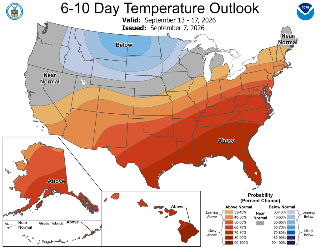
A change in the weather pattern is on the horizon, according to agricultural meteorologist Greg Soulje's outlook published September 8, 2026 by Brownfield Ag News.
Looking ahead, the 6- to 10-day outlook calls for the likelihood of below-normal temperatures from the northern Rockies into the upper Great Lakes region. In contrast, warmer-than-normal weather will prevail south of a line extending from central California to southern Maine.
For agriculture, early-September temperature swings carry practical weight: the northern Rockies and upper Great Lakes fall within or near spring wheat, sugarbeet, and small-grain territory, where crops are typically in or approaching harvest, while the southern tier covers corn and soybean areas that generally remain in later reproductive to maturing stages this time of year.
Meanwhile, near- or above-normal precipitation is expected across most of the country, which should contrast with drier-than-normal conditions in the Pacific Northwest.
Source: Brownfield Ag News
