Atlantic Hurricane Season Nears as NHC Monitors Two Systems With Elevated Cyclone Odds
Key Takeaways
- •The National Hurricane Center has identified a mid-Atlantic weather system with a 60% probability of tropical cyclone development within its seven-day forecast window.
- •A second system, with a 10% formation chance, is being closely watched because its trajectory could carry it into the Gulf of Mexico, home to significant US energy infrastructure.
- •The Atlantic hurricane season officially runs from June 1 through November 30, with peak activity typically occurring between mid-August and late October.
- •The United States has been drawing on petroleum reserves to support international supplies, heightening the potential market impact of any storm-related disruption to Gulf production and refining.
- •The NHC is scheduled to release its seasonal outlook, which will provide aggregate guidance on expected storm frequency and intensity for the upcoming season.
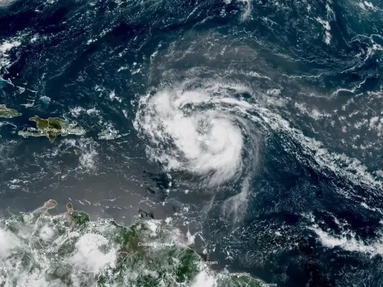
The Atlantic basin is approaching hurricane season, and forecasters are already monitoring two weather systems in the mid-Atlantic that could signal an early start to storm activity.
The National Hurricane Center (NHC) has identified a system with a 60% probability of developing into a tropical cyclone within its typical seven-day outlook window, currently highlighted in orange on its advisory map. A second system carries a 10% chance of cyclone formation. Of the two, the second system is drawing particular attention due to its trajectory, which could potentially carry it into the Gulf of Mexico—a region densely populated with energy infrastructure. The first system appears to be tracking northward along a path that typically steers storms toward the open North Atlantic. Storm formation before the official start of hurricane season is not unprecedented, though it often prompts heightened attention from both meteorologists and market participants assessing early-season risk.
The Atlantic hurricane season officially runs from June 1 through November 30, with peak activity generally occurring between mid-August and late October. During this period, the NHC continuously monitors tropical disturbances and issues advisories on developing systems, classifying them as tropical depressions, tropical storms, or hurricanes based on sustained wind speeds.
This year's season carries heightened significance for global energy markets. The United States has been drawing on petroleum reserves to help bolster international supplies, meaning that any weather-related disruptions to production, refining, or transportation infrastructure could have outsized effects on global petroleum product prices and liquefied natural gas (LNG) markets. The Gulf of Mexico accounts for a substantial share of US crude oil and natural gas production, making it a critical area of vulnerability during active storm periods.
Forecasters and energy analysts will be closely watching the evolution of both systems in the coming days, alongside the NHC's scheduled release of its seasonal outlook, which provides aggregate guidance on expected storm frequency and intensity.
Source: ForexLive / InvestingLive